
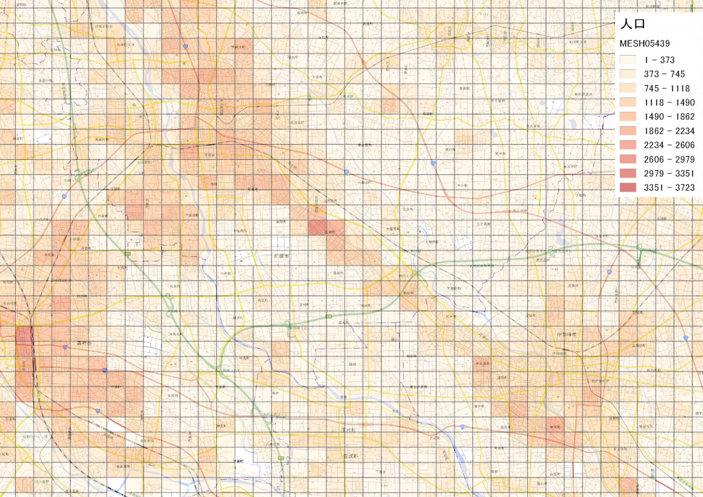
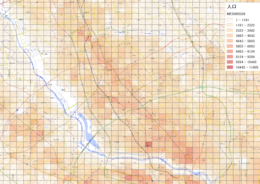
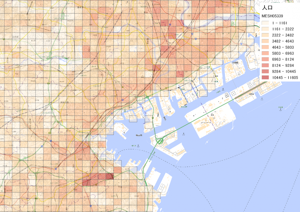
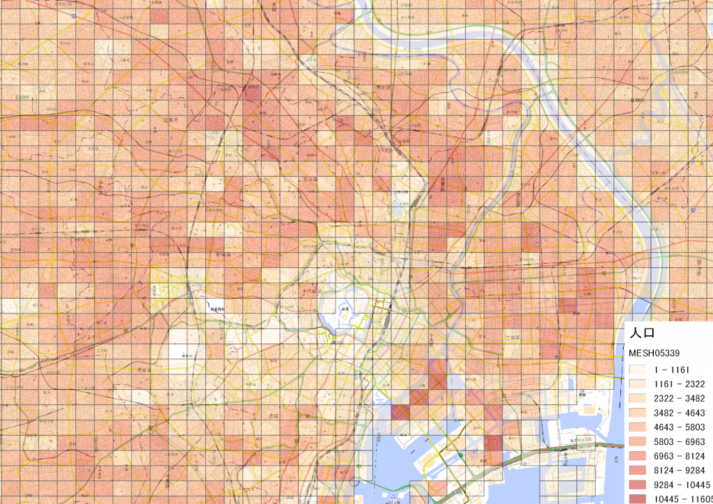
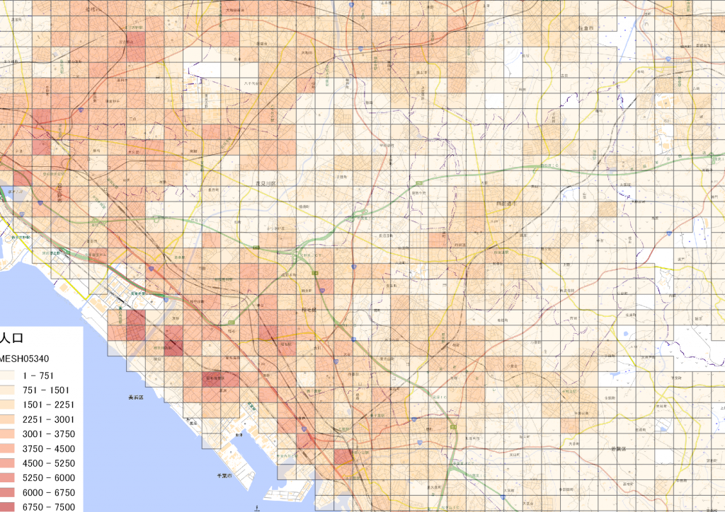
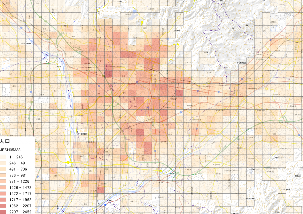
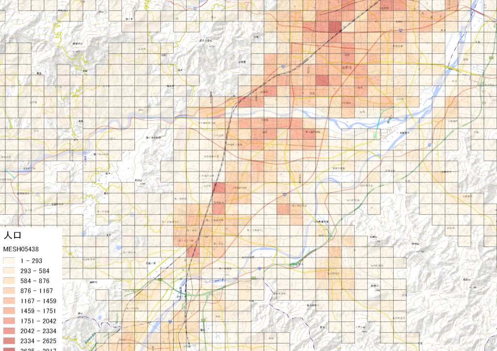
新規に動物病院を開業する場合には、人口が大事です。人口が多ければ、犬猫の数も多いと思われます。人口を地図上に表示して、人口分布を見たいと思います。
動物病院のデータを乗っけるのは、少し気が引けたのでやめておきました。住所からジオコーディングして、QGISに読み込ませれば地図の上に乗せることができます。
利用したソフト
QGIS
利用した地図・データ
- 国土地理院 標準地図
- 政府統計の総合窓口(e-Stat)(https://www.e-stat.go.jp/)
- 国勢調査 2015年 その1 人口等基本集計に関する事項 人口総数 4次メッシュ(500mメッシュ) を加工して作成
- 統計データ(https://www.e-stat.go.jp/gis/statmap-search?page=1&type=1&toukeiCode=00200521&toukeiYear=2015&aggregateUnit=H&serveyId=H002005112015&statsId=T000847)
- 境界データ(https://www.e-stat.go.jp/gis/statmap-search?page=1&type=2&aggregateUnitForBoundary=H&coordsys=2&format=shape)
群馬 前橋
埼玉県 さいたま市
神奈川県 横浜
東京都
千葉県 千葉市
山梨県 甲府市
長野県 長野市
Map created using the Free and Open Source QGIS